Global leader in flood and climate risk

How banks are exploring cat risk modeling
The playbook for flood underwriters in a changing climate
Fathom launches FathomDEM+, new world-leading accurate terrain data

How is the financial sector rethinking physical climate risk?

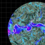
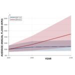
Quantifying future flood risk: Inside Global Flood Cat | Future

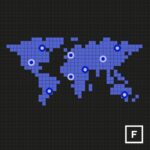
US Flood Risk Index: Reveal hidden flood risk. Prevent avoidable losses.

FathomDEM: an improved global terrain map using a hybrid vision transformer model
Introducing Global Flood Cat—The first truly global catastrophe model to cover all major flood perils.
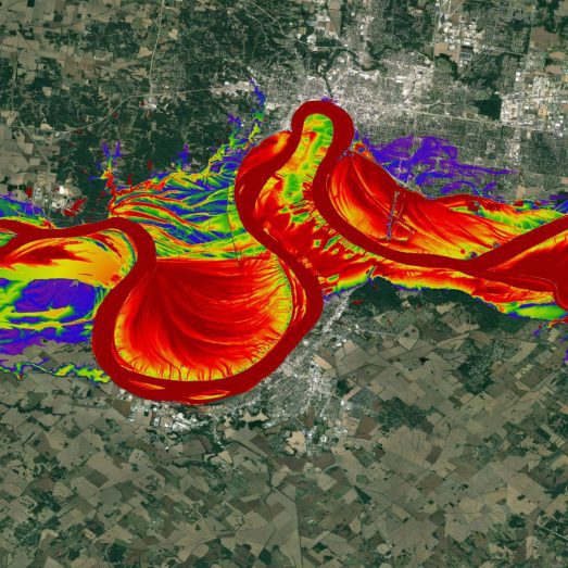
A 30 m global flood inundation model for any climate scenario

Metadata — Fathom’s first-of-its-kind assessment of flood risk data certainty

Swiss Re acquires Fathom, global leader in water risk intelligence
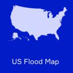
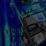
New US Flood Map – The most complete and technologically advanced flood map for the United States

Fathom Risk Scores – Powerful flood risk metrics for any global location, under any climate scenario
Climate change is
happening now
Fathom’s cutting-edge products support you to understand what impact climate change has on your flood risk both now and in the future. Our solutions are well established within the industry and set a new benchmark in global flood mapping.
Fathom has been providing high quality flood risk intelligence across a wide range of sectors since 2013


Academic scrutiny of our products gives our clients the reassurance that they are consuming trusted and transparent data from the forefront of science

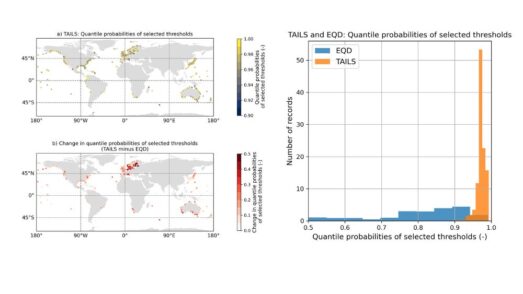
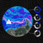
Automated tail-informed threshold selection for extreme coastal sea levels
A new method, TAILS, sharpens how we identify extreme events by focusing on the most critical data, giving clearer, more reliable estimates of future coastal hazards worldwide.
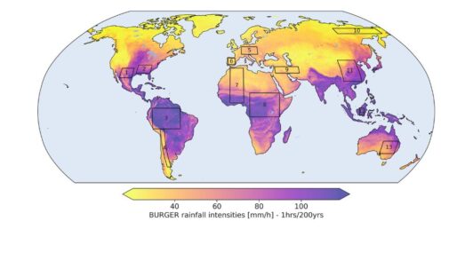
Introducing BURGER, Fathom’s new extreme rainfall dataset
New research by Fathom’s Senior Hydrologist, Dr Jannis Hoch, and other Fathom scientists describes Fathom’s new dataset, Bottom Up Regionalised Global Extreme Rainfall, or BURGER for short. It’s the first of its kind to be created from rainfall gauge data and the first to contain extreme estimates for durations as short as an hour.
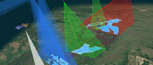
Satellite Requirements to Capture Water Propagation in Earth’s Rivers
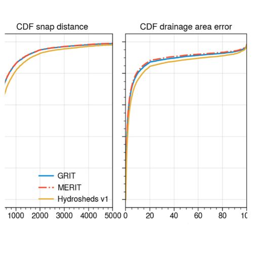
Global River Topology (GRIT): A bifurcating river hydrography
Researchers have created the first branching global river network that represents bifurcations, multi-threaded channels and canals.
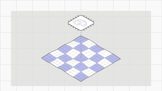
FathomDEM Global Terrain Map
A new research paper published in Environmental Research Letters outlines the creation of FathomDEM, a new global 30 m DEM produced using a novel machine-learning approach.
Fathom insights
Calculating flood risk in a changing climate: a guide for underwriters
Beyond the black box: Flood risk, regulation, and the future of capital markets